Google Maps heatmap: Cats
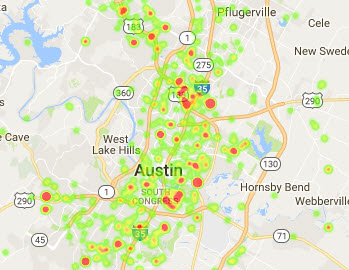
Frequency of cat intakes was less dense than dogs, and spiked in select areas primarily east of the I-35 corridor, with the exception of Hwy 183 where there were additional small spikes.
Visualizations
.jpg)
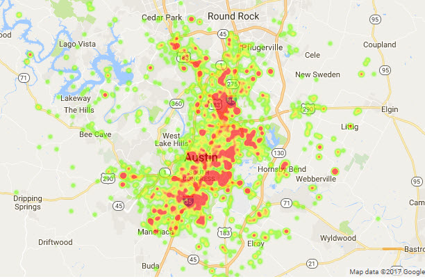
Frequency of cat intakes was less dense than dogs, and spiked in select areas primarily east of the I-35 corridor, with the exception of Hwy 183 where there were additional small spikes.